Archaeology and palaeontology
Excavation of the Byzantine city of Androna / al-Andarin in Syria
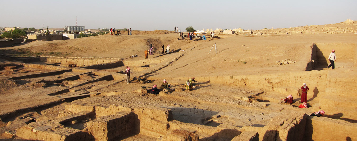
Al Andarin, the ancient Androna, lies in the middle of the Syrian desert steppe and is mentioned in contemporary writings as early as the 3rd century AD.
The Byzantine settlement with an area of around 160 hectares is bordered by an outer ring of walls, while an inner ring of walls of a different design exists in parts. Various public buildings (11 churches, military buildings, baths) and numerous houses under sand drifts can be found within the outer ring of walls.
Following a geodetic survey in 1997, international excavation work (a Syrian team, a team from Oxford University and a German team under the direction of Prof Dr Christine Strube) has been carried out since 1998.
The aim of the surveying work – in addition to recording and mapping the surface features – is primarily to measure the landforms (DTM).
Excavation project Universität Heidelberg (1997 bis 2007)
Excavation project Universität Heidelberg (seit 2010)
Excavation project University of Oxford
The dinosaur tracks of Münchehagen
In August 2004, thirteen tracks of dinosaurs were found in a quarry in Münchehagen – 140 million year old ‘evidence’ of iguanodontid dinosaurs! After uncovering them, it quickly became clear that these were the longest tracks of an iguanodon (ornithopod) ever found in the world. As if that wasn’t enough, further searching at the beginning of October 2005 revealed the smallest footprint of an Iguanodon found anywhere in the world – a ‘baby’ so to speak.
In addition to the predominant traces of herbivorous dinosaurs, there are also traces of somewhat smaller, carnivorous dinosaurs. As further tracks are expected, the Lower Saxony State Museum in Hanover, the quarry operator Wesling and the nearby Dinopark Münchehagen are working together to uncover the tracks.
After precise surveying documentation of the current find situation for scientific analyses, hopefully more tracks will be uncovered in the near future.
3D documentation of the Tell Halaf exhibition
Conservation of the special exhibition using a terrestrial laser scanner. Flight through the ‘Palace of Kapara’ with transition to the large tomb figure.
Documentation of the Höwenegg fossil site
Excavation at the settlement mound Tell Halaf / Guzana in Syria
In 1899, Max Freiherr von Oppenheim, a German diplomat and private scholar from a wealthy banking family, carried out the first excavations on Tell Halaf (the Aramaic Guzana) in Syria, one of the most famous settlement mounds in the Near East. After extensive preparations, the main excavation took place between 1911 and 1913, followed by another short campaign in 1929.
He unearthed a large number of important sculptures from the 1st millennium BC, including three monumental statues of gods serving as columns, a replica of which now adorns the entrance to the National Museum in Aleppo. Tell Halaf is also the eponymous site of an important prehistoric culture of northern Mesopotamia (approx. 6000 – 5300 BC) – the so-called ‘Halaf period’.
The sculptures that Max von Oppenheim had excavated and which he was able to transfer to Berlin after splitting up the finds in 1929 were exhibited in a former factory building. The museum was destroyed by a firebomb in 1944, the sculptures were destroyed and were considered lost after the war. They were found in the basement of the Pergamon Museum after reunification and the more than 27,000 fragments were lovingly restored over many years. From January to August 2011, a special exhibition was dedicated to the ‘resurrected’ sculptures and Max von Oppenheim at the Pergamon Museum in Berlin.
Since 2009, the excavation, which was resumed in 2006 by the Vorderasiatisches Museum Berlin, the Universities of Halle and Tübingen and the Syrian Antiquities Administration, has been supervised by our office in terms of surveying. In addition to the surveying tasks accompanying the excavation to support the daily archaeological field work, one of the tasks is the transfer of the old excavation plans into a new UTM coordinate system, which was set up by the Karlsruhe University of Applied Sciences in 2006/7. The further the long-term excavation project progresses, the more reliable the results of this transfer will be.
Further links: